Satellites confirm that climate predictions of sea level rise in the mid-1990s were largely accurate, despite underestimating ice melt. Satellites have been tracking global sea level changes for more than three decades. A recent analysis shows that predictions made in the mid-1990s were surprisingly accurate. The study, published in Earth's Future, an open-access journal of the American Geophysical Union, comes from two researchers at Tulane University.
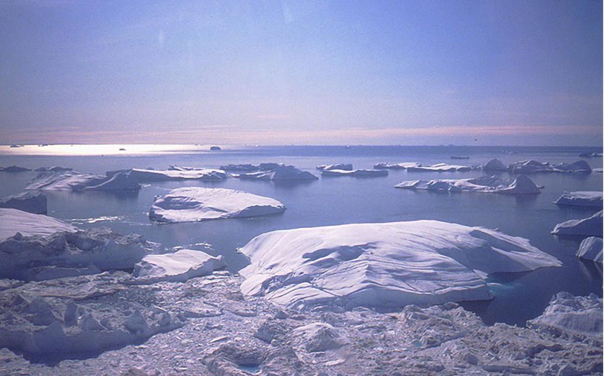
Icebergs in Disko Bay, West Greenland, discharged by Jakobshavn Isbrae, one of the fastest-moving outlet glaciers in the world. The massive loss of the Greenland ice sheet has caused global sea levels to rise by nearly 2 centimeters (three-quarters of an inch) over the past three decades. Image credit: Torbjörn Törnqvist/Tulane University
"The ultimate test of a climate prediction is to compare it with actual results after the prediction, but this requires patience—it takes decades of observations," said the study's lead author Torbjörn Törnqvist, the Vaux Professor of Geology in the Department of Earth and Environmental Sciences.
"We were very surprised by the accuracy of the early predictions, especially considering how crude the models then were compared to those today," Tornqvist said. "For those who question humanity's role in climate change, here is some of the best evidence that we have known for decades what is actually happening and can make reliable predictions."
Co-author Sönke Dangendorf, David and Jane Flowerree associate professor in the Department of River Coastal Science and Engineering, added that while the accuracy of early models is encouraging, the priority today is refining global data into localized predictions to guide planning in vulnerable areas like South Louisiana.
"Sea level rise is not uniform but varies widely. Our recent studies of this regional change and the processes behind it have relied heavily on data from NASA satellite missions and NOAA's Ocean Monitoring Program," he said. “Continuing these efforts is more important than ever and critical to making informed decisions that benefit coastal residents.”
In the early 1990s, satellites were launched into space to measure sea level height, ushering in a new era of monitoring global sea level changes. Since then, global sea levels have risen on average about one-eighth of an inch per year, satellites show. Until recently, it was not possible to detect that global sea level rise is accelerating.
When NASA researchers demonstrate in October 2024 that this rate has doubled over the 30-year period, it will be time to compare this finding with predictions made in the mid-1990s that were made independently of satellite measurements.
In 1996, shortly after satellite sea level measurements began, the Intergovernmental Panel on Climate Change issued an assessment report. The report predicts that global sea levels are most likely to rise by nearly 8 centimeters (3 inches) over the next 30 years, which is very close to the actual current rise of 9 centimeters. But it also underestimated the impact of melting ice sheets by more than 2 centimeters (about 1 inch).
At the time, little was known about the role of ocean warming and how it could destabilize the Antarctic ice sheet's oceanic regions from below. The Greenland ice sheet is also flowing into the ocean faster than expected.
Past difficulties in predicting ice sheet activity also point to future developments. Current projections of future sea level rise take into account the possibility of catastrophic ice sheet collapse before the end of the century, although this probability is uncertain and low. If a similar collapse occurred in Antarctica, low-lying coastal areas of the United States would be particularly hard hit.
Compiled from /scitechdaily