Multiple Earth observation satellites of the National Aeronautics and Space Administration (NASA) recently simultaneously monitored a rare submarine volcanic eruption in the Bismark Sea in northern Papua New Guinea. This event may "create" the latest young island on earth in the deep ocean basin. Scientists pointed out that this eruption not only exposed the blind spots in human understanding of deep-sea topography, but also provided a rare natural experimental field for using multi-source satellite data to study submarine volcanic activity.
Oceanographers have long pointed to an ironic fact to illustrate the shortcomings of deep-sea research: Fine topographic maps of the surfaces of the Moon and Mars are often more accurate than those of Earth's deep seafloor. This gap is particularly obvious in the Bismark Sea, where the seafloor structure is extremely complex, with faults, volcanic structures, rifts, cliffs, active subduction zones and spreading centers intertwined. However, there is a lack of high-resolution topographic data due to the large water depth and the difficulty of sonar measurement.
The undersea volcanic eruption occurred in the middle of the Bismark Sea. On May 8, regional seismometers first recorded a cluster of small-scale seismic activity, kicking off the eruption. Subsequently, multiple satellites quickly captured obvious signs of volcanoes: Since May 9, NASA’s Aqua and Terra satellites have recorded multiple white volcanic plumes rich in water vapor rising into the atmosphere in visible light images; the sea color sensor of the PACE satellite has detected sea water color anomalies and water disturbances around the eruption point.
Existing analysis believes that the eruption may have occurred on a volcanic tectonic belt called "Titan Ridge", about 16 kilometers southeast of a submarine eruption site that was recorded in 1972. However, the geophysics and volcanology communities have not yet reached a consensus on the specific erupting volcanic body, the original water depth of the eruption vent, and its historical activity records. The lack of fine seafloor topographic data leaves great uncertainty in the structural background and deep-water environment of this eruption.
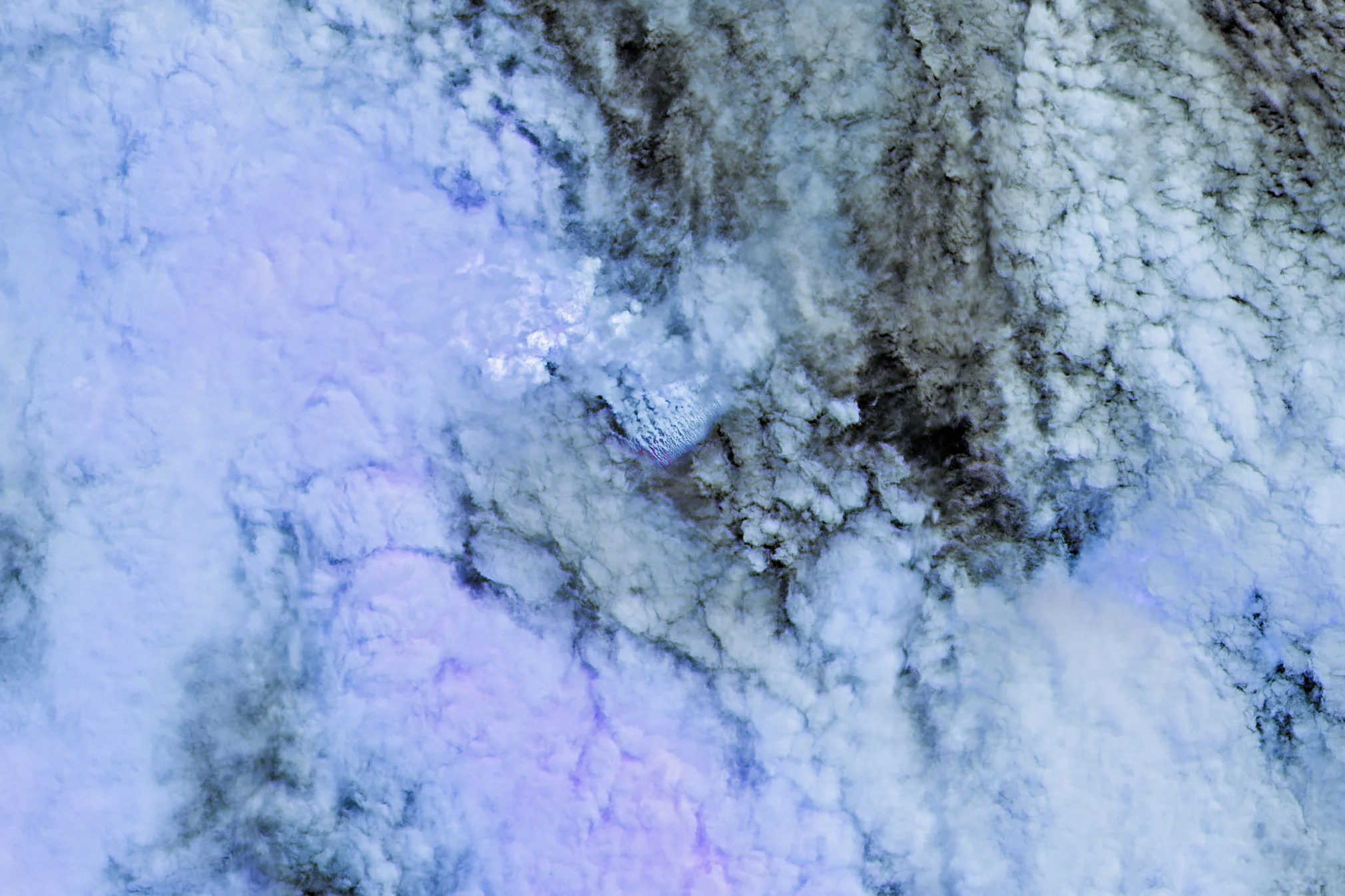
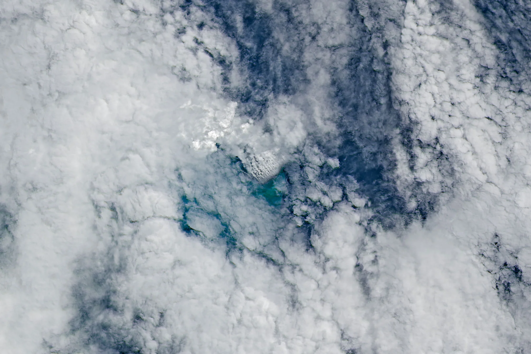
More detailed satellite images come from Europe's Sentinel-2 and Landsat 9 jointly operated by NASA/US Geological Survey. The images they acquired on May 10 and 11 show that the eruption activity is very close to the sea surface. In a false-color composite (band 7-6-5) image, scientists clearly identified areas of thermal anomalies via infrared signals. On May 12, the VIIRS instrument onboard the Suomi NPP satellite further detected widespread thermal anomalies over an area of about 7 square kilometers, indicating that a large amount of high-temperature material is close to the surface of the seawater.
Simon Carn, a volcanologist at Michigan Technological University, pointed out that such extensive thermal anomalies mean that the eruption vent is most likely located in a relatively shallow water environment, which is inconsistent with the "hundreds of meters of water depth" shown by traditional seafloor bathymetry data. He believes that this implies that there are errors in topographic mapping in this area, and may also reflect that recent tectonic activities have significantly changed the local seafloor topography.
Judging from the optical images, the current eruption activity is extremely violent in the shallow sea area, with large areas of seawater discoloration and multiple steam and ash vents distributed on the sea surface. Medium- and high-resolution sensors from multiple government and commercial satellite programs simultaneously recorded large-scale pumice rafts - large amounts of pumice driven by ocean currents to form long floating bands that extend astonishingly. These floating pumice are not only direct evidence that volcanic debris entered the sea surface, but may also subsequently change regional marine ecology and shipping safety.
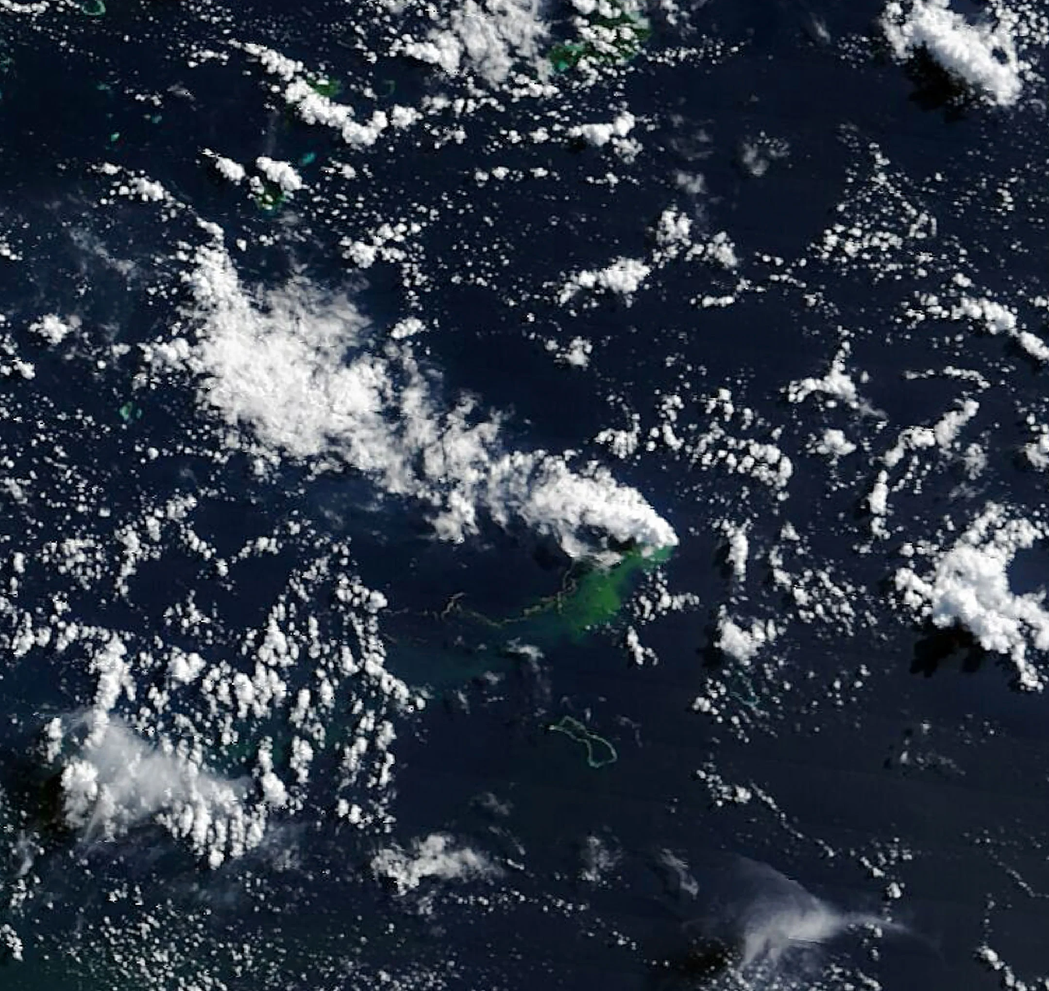
In an image obtained by the MODIS instrument on board the Terra satellite on May 15, white volcanic cloud plumes can be seen drifting over the west side of the eruption point, while floating pumice groups on the sea surface and a large area of green discolored water extend to the southwest. This further confirms that eruptions are mixing with seawater at depth and spreading with ocean currents, leaving a "fingerprint" of volcanic activity in the wider ocean.
Jim Garvin, chief scientist at NASA's Goddard Space Flight Center, said that the scientific research team is currently paying close attention to the eruption dynamics and "cannot wait to know whether a brand new island is on the verge of being born." He pointed out that humans have rarely been able to witness a new volcanic island "breaking out of the ground" from the bottom of the sea to the sea surface in real time with such a systematic satellite observation method.
If the new land eventually emerges and remains, volcanologists will continue to track its morphological evolution. In the future, the new islands may develop into tuff cones with caldera craters, or they may quickly collapse and disappear due to wave erosion and structural instability. Once seawater further comes into direct contact with shallow magma chambers, the eruption pattern may also change to a more explosive water-magma interaction, resulting in more violent energy releases and volcanic ash clouds.
Compared with several violent undersea eruptions that have attracted much attention in recent years, the overall explosiveness of this eruption in the Bismark Sea is relatively limited. In 2022, Tonga’s “Hunga Tonga-Hunga Ha’apai” submarine volcano released huge energy in a short period of time, generating strong atmospheric gravity waves and having a measurable impact on global atmospheric circulation; the 2021 eruption of Japan’s “Fukutoku-Okanoba” submarine volcano also caused large-scale volcanic ash drift and sea surface pumice disasters. In contrast, the current eruption is more like a "relatively mild" submarine volcanic activity occurring on a spreading tectonic background.
Kahn's analysis believes that this event may be related to a volcanic ridge and its nearby transform faults and back-arc basin expansion centers. Volcanic eruptions formed in the context of spreading centers are usually dominated by basaltic lava and are relatively weak in explosiveness; while the most explosive eruptions usually occur in subduction zones and are dominated by volatile-rich, high-viscosity magma in large stratovolcanic systems. This tectonic difference means that the probability that this eruption in the Bismark Sea will evolve into an extreme explosive event is currently estimated to be low.
The duration of the eruption remains one of the most uncertain variables at present. A submarine eruption in the same sea area in 1972 lasted only about four days, but a submarine eruption in St. Andrew Strait (St. Andrew Strait) about 100 kilometers away from the event in 1957 lasted for nearly four years before ending. This suggests that submarine volcanic activity within a large area may vary greatly in both time scale and energy output.
In order to more systematically characterize the new land forms that may have been created by this eruption, Gavin and related teams plan to mobilize a variety of radar remote sensing resources. These include the recently commissioned NASA–ISRO jointly developed NISAR radar satellite and the Canadian Space Agency’s RADARSAT constellation mission. Synthetic aperture radar can continuously acquire surface and sea surface deformation data under cloudy, rainy and even nighttime conditions, providing key support for accurately mapping the topography and short-term evolution of new islands.
Once an island with a certain degree of stability is formed, researchers will have an almost "from scratch" natural experimental platform to conduct a series of studies on the early evolution of the island. Previous field investigations on Tonga's newly born island "Hung'a Tonga-Hung'aha'apai" have shown rich details in the process of vegetation and animal colonization, rainfall erosion, chemical weathering and wave modification of the young volcanic island. Gavin proposed that "island-nauts" may land on this type of new land again in the future, using close-range observations in conjunction with satellite remote sensing to compare the commonalities and differences of different volcanic islands in their early stages of evolution.
From a more macro perspective, this type of "new island laboratory" is also seen as an opportunity to provide control samples for human return missions to the moon. Gavin emphasized that the upcoming Artemis IV mission will once again send female and male astronauts to the moon. Humanity urgently needs more Earth analog scenes that are close to the "extraterrestrial environment" in order to verify exploration strategies and scientific instruments in complex surface environments. In his view, if this submarine volcanic eruption in the Bismark Sea eventually creates a young island that has existed for a long time, it may become one of the core samples for future multidisciplinary interdisciplinary research on geology and planetary science.