On the British Virgin Islands' Anegada island, scientists discovered hundreds of large coral boulders scattered across the interior. The gray-white appearance of these boulders shows traces of long-term weathering, and the cause of their formation has always attracted much attention. The latest research confirms that these boulders were moved to their current location by a massive tsunami at the end of the 14th century. The research results have been published in Geophysical Research Letters.
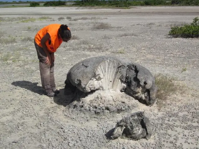
Researchers ruled out the possibility of a hurricane being the cause. Modeling calculations show that even the highest-level hurricanes do not have the hydrodynamic conditions to move such huge coral blocks. Uranium dating method was used to analyze nine coral samples, and it was determined that the time when they left the seawater environment was concentrated between 1381 and 1391 AD, which provided accurate time evidence for the occurrence of the tsunami.
Research points out that this tsunami is likely to originate from an earthquake of magnitude 8 or above in the Puerto Rico Trench. The trench is only about 100 kilometers away from Anegada Island and is the boundary zone where the North American plate subducts beneath the Caribbean plate.
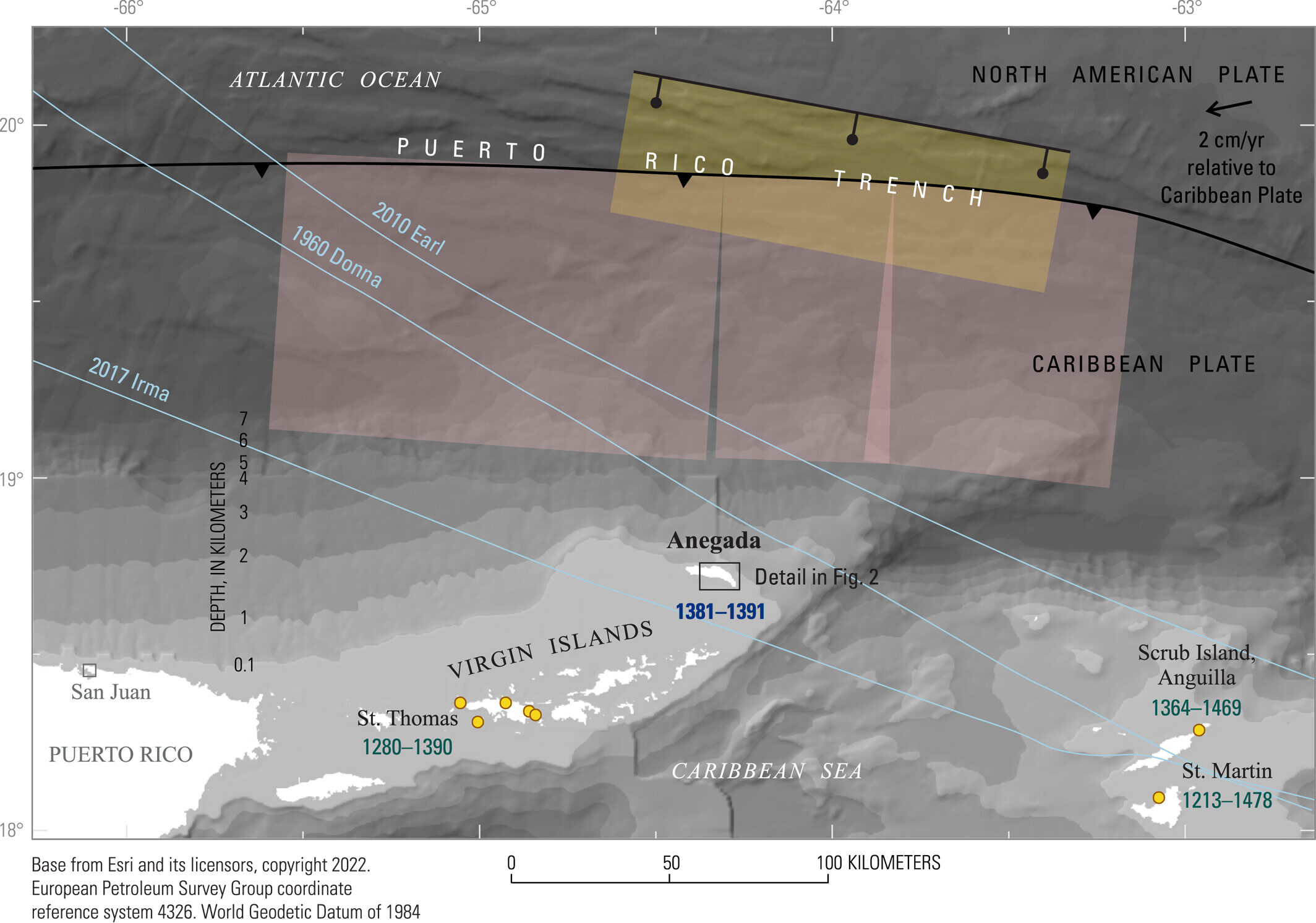
Geological records show that the plate convergence rate in the Puerto Rico Trench is slow, about 2 centimeters per year, resulting in recurrence cycles of major earthquakes that can last for thousands of years. However, once a strong earthquake occurs, the resulting tsunami will reach surrounding islands within tens of minutes. This tsunami threat is particularly serious considering that the highest point of Anegada Island is only 8 meters above sea level.
Currently, the research team is seeking more evidence from outside the region, including reviewing historical records along the Atlantic coast, to further verify this finding. These studies have important implications for understanding earthquake and tsunami risks in the Caribbean.