Niantic is turning the same global AR technology that once kept Pikachu firmly planted on real-world sidewalks to directing a more down-to-earth protagonist—a delivery robot that shuttles across the sidewalk in search of the correct house number. Through positioning data and street view images accumulated over the years, the company now provides centimeter-level precision visual positioning services to companies such as Coco Robotics, specifically solving the old problem of traditional GPS being "lost" in cities with high-rise buildings.
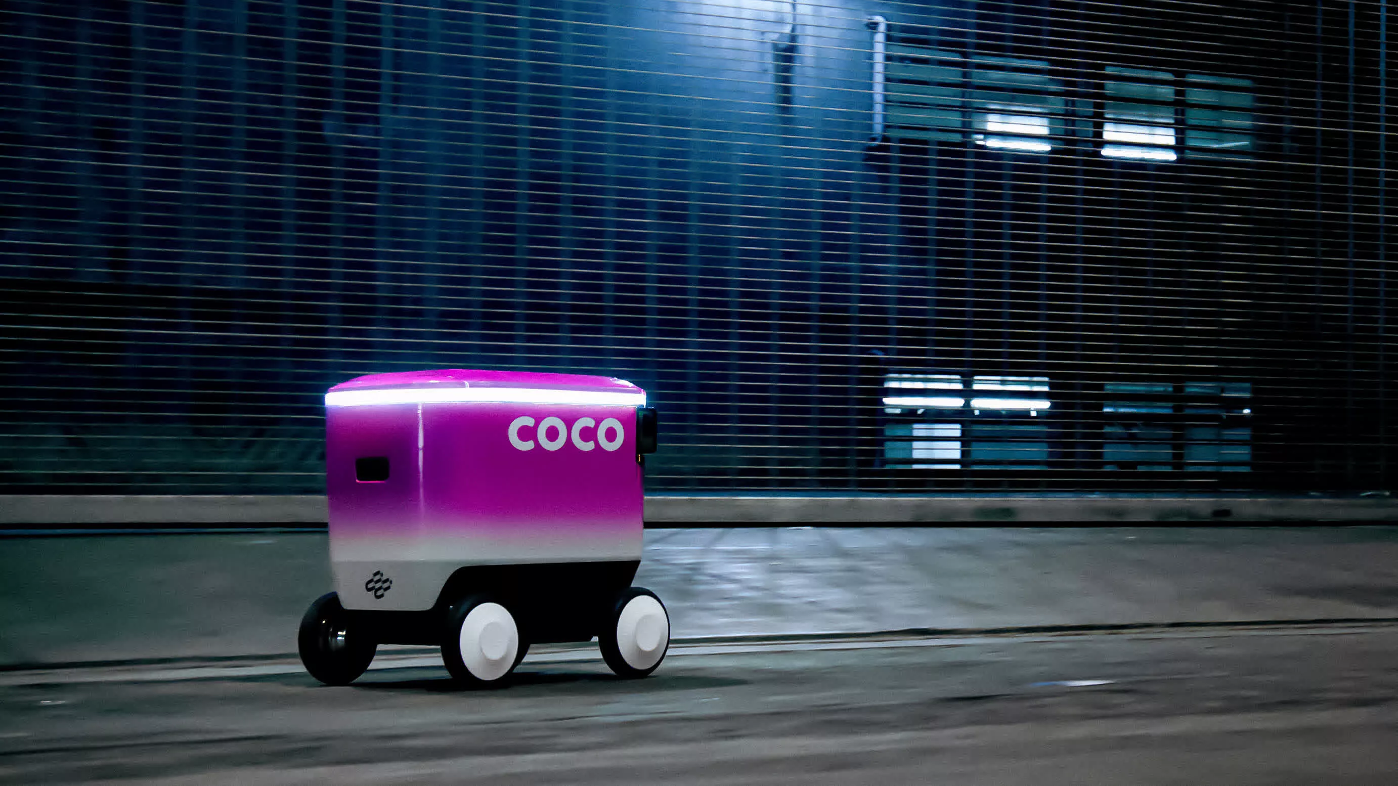
Niantic Spatial is an AI spin-off company hatched by Niantic in 2025 that specializes in distilling years of mobile gaming data into highly accurate real-world "world models." According to the official description, this is a visual positioning system (VPS) that can determine the position and attitude of the device within a centimeter range by relying only on camera images and map context, and provides services to the outside world through commercial interfaces. Its first large-scale commercial partner is Coco Robotics, an end-delivery company that operates about a thousand sidewalk robots in many European and American cities. Local satellite signals are often too noisy to support reliable autonomous driving.
The technical problem that Niantic Spatial needs to solve is not difficult to describe, but it is very difficult to truly overcome: in a high-density urban environment, GPS signals are reflected between glass curtain walls and concrete, and positioning errors can easily reach tens of meters. For a delivery robot, this deviation is enough to cause it to end up in the wrong neighborhood, or even the other side of the street. Coco's robot cruises at about five miles per hour and can deliver multiple oversized pizzas or bags of groceries at once. If it wants to keep up with human riders in terms of punctuality and pick-up and delivery accuracy, it must rely on more stable and precise navigation capabilities.
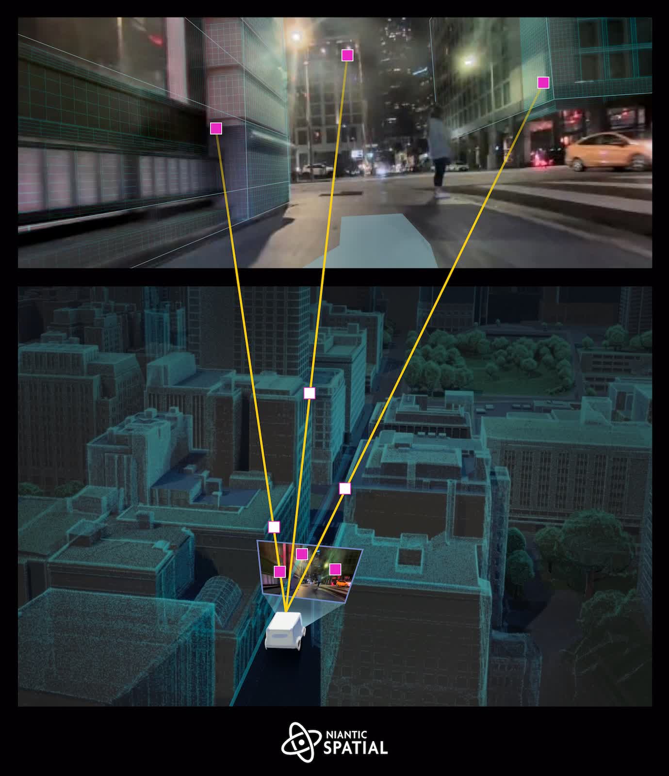
Niantic Spatial's alternative is a visual positioning system that relies on "seeing" rather than radio signals. For years, the company has been aggregating data from Pokémon Go and its earlier augmented reality game Ingress, both of which encourage players to visit real-world gyms, battle arenas and various points of interest. This game mechanism invisibly builds a dense set of global urban data sets: the massive images taken by players in the urban environment are accurately bound to the longitude and latitude, camera orientation, device posture, motion status and other sensor data recorded by the mobile phone.
According to Niantic Spatial, its model training data contains approximately 30 billion images, highly clustered around more than a million "hotspot" locations that are photographed repeatedly from different angles, at different times of day, and in various weather conditions. Since each frame corresponds to centimeter-level pose estimation, this training set essentially constitutes a multi-view 3D sampling, covering city streets, crosswalks, storefronts, and building facades. On this basis, the model can infer precise location and orientation from a small number of images taken in real time, even in areas where the original data coverage is not as dense as these hot spots.
For Coco, this means its robots can fuse GPS signals with camera positioning results provided by Niantic Spatial. Each robot is equipped with four cameras installed at "hip height" to shoot from four directions. This perspective is different from that of humans holding a mobile phone in their hands, but Coco said that adapting this kind of data to existing models is relatively intuitive. At present, these robots have completed hundreds of thousands of deliveries in Los Angeles, Chicago, Miami, Jersey City, Helsinki and other places, and have traveled more than one million miles in total, providing the company with a baseline for evaluating the reliability improvement of the new system.
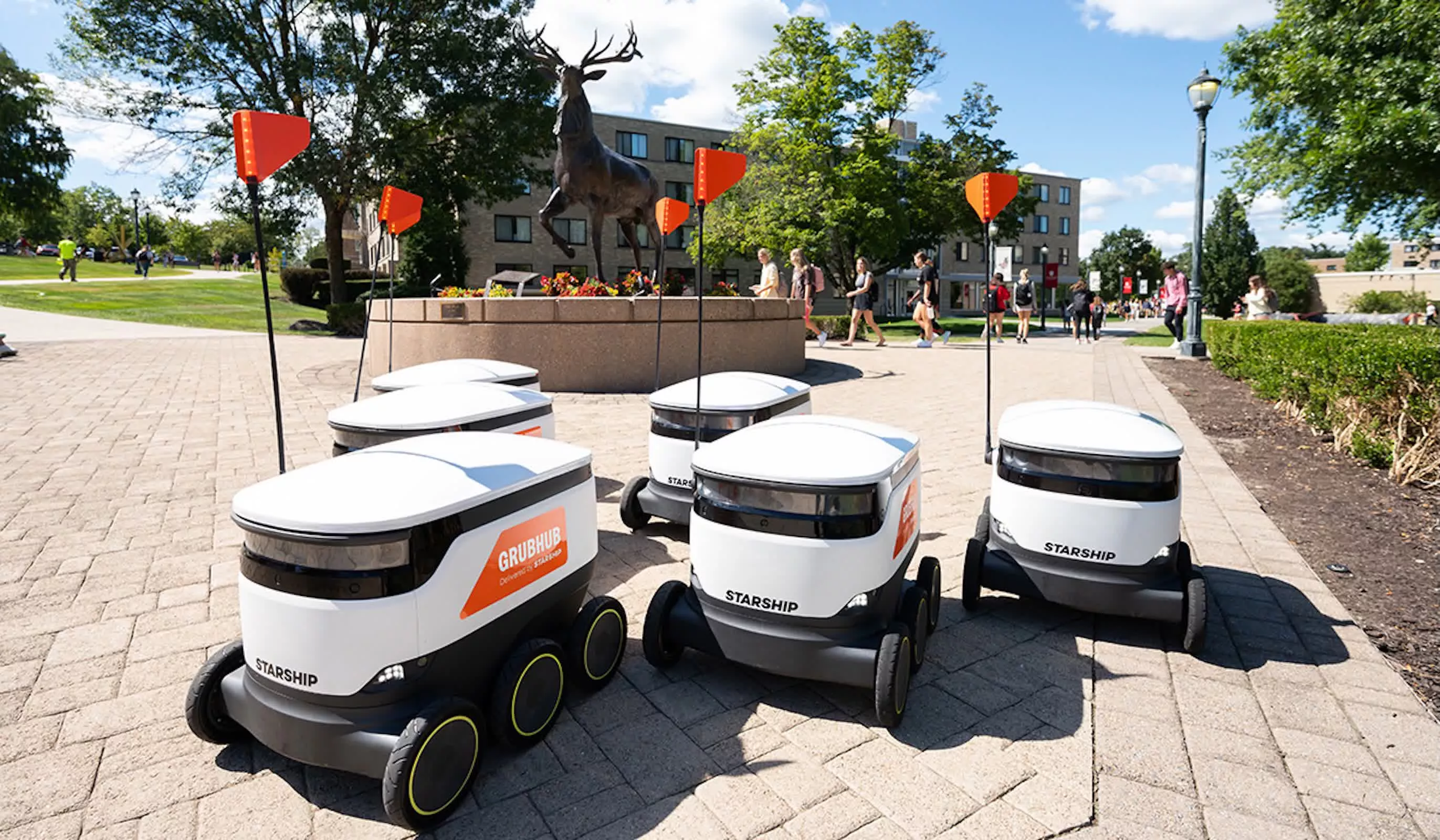
Visual positioning itself is not a new concept, but it has long been limited by the collection density and coverage of high-quality images. Niantic Spatial is betting that the volume and diversity of its crowdsourced gaming data will outperform competitors that rely primarily on their own fleets of sensors to collect maps. Some other delivery robot manufacturers (such as Starship Technologies) usually build local 3D maps on the running path through their own sensors, recording curbs, street signs, building outlines, etc., and then reuse these maps during subsequent trips. In contrast, Niantic Spatial hopes to maintain a globally shared geospatial model and make it available through an API to any robot, phone or headset that needs precise positioning.
Niantic calls this model a “living map”: a virtual representation of the world that is updated with sensors at all times. As Coco’s robots and more future partners navigate the streets and sidewalks, their sensors will continue to return new observations that are used to correct and expand Niantic Spatial’s underlying map. The goal is not just geometric accuracy, but also semantic understanding—annotating and describing various types of objects in a map in a machine-understandable way.
Niantic executives see the effort as part of a long-term evolution of digital maps, rather than a complete reversal. From 2D maps to 3D and now to the analog world moving toward dynamic “digital twins,” the core connection between map coordinates and physical space remains unchanged. What has really changed is the “main consumer” of such maps: from people in the past to machines. From this perspective, the spatial intelligence that was used to ensure that the virtual Pikachu stood firmly on the sidewalk is now being transplanted to a delivery robot that weighs a hundred pounds and needs to maintain a stable route in wind, rain and traffic.