
Abstract:
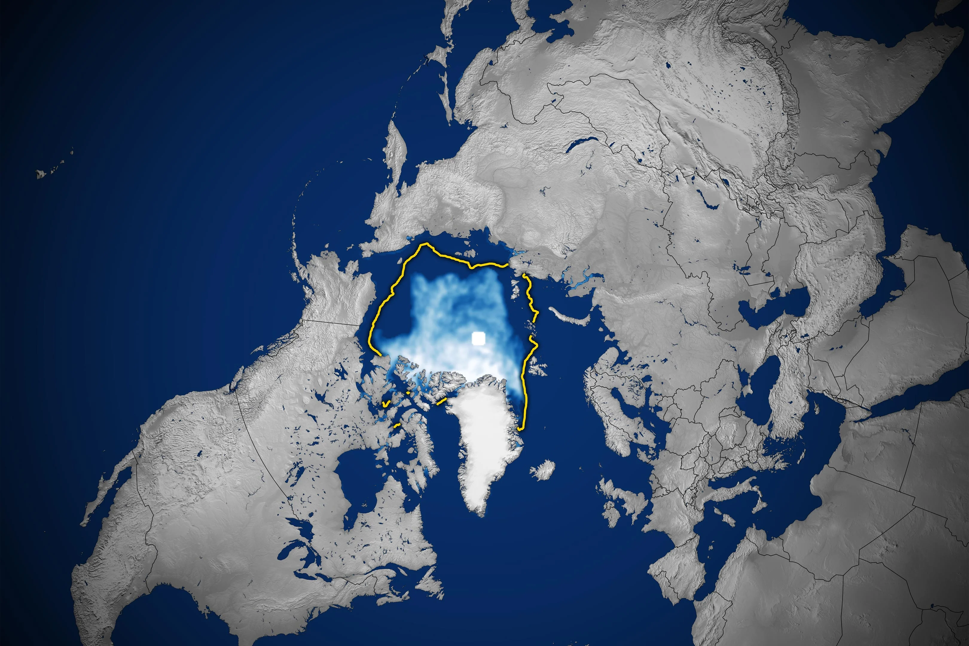
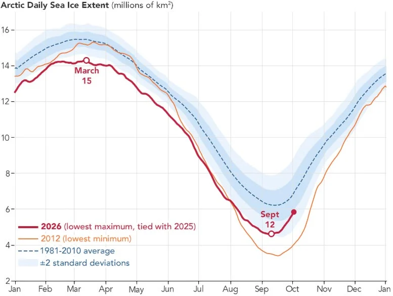
NASA satellite data shows that Arctic sea ice covers less sea area in both winter and summer than a few decades ago, and the remaining ice is getting younger and thinner. Arctic sea ice in 2026 dropped to its annual minimum on September 12, covering an area of approximately 4.6 million square kilometers. It was tied for the tenth lowest in the nearly 48-year satellite record with 2008, 2010 and 2025.
This is still well above the record low of 3.39 million square kilometers set in 2012, but about 1.62 million square kilometers less than the average minimum from 1981 to 2010, and an area almost the size of Alaska. The U.S. National Snow and Ice Data Center pointed out that the lowest value in 2026 is preliminary statistics and may be affected by subsequent wind compression of sea ice or late season melting; however, the past 20 years have included the 20 lowest annual minimum values in satellite records.
From 1979 to 2026, the minimum extent of September sea ice in the Arctic has shrunk at a rate of approximately 11.8% per decade as a whole, a linear trend equivalent to a decrease of approximately 73,200 square kilometers per year. At the same time, there has been no significant sustained decline in minimum values over the past two decades, and interannual variability remains evident. Scientists point out that Arctic sea ice is affected by weather and natural climate fluctuations. Changes in cloud cover in recent years may also reduce the amount of sunlight reaching the ice surface, causing the ice melt rate to temporarily slow down in summer; this does not mean that the long-term shrinkage trend has been reversed.
Changes don’t just happen in the summer. Arctic sea ice typically reaches its annual maximum extent in March and reaches its minimum in September, but the winter peak in March 2026 tied with 2025 for the lowest in satellite records. At the same time, multiyear ice, thicker sea ice that has survived at least one summer, continues to decline, and the Arctic is increasingly dominated by thinner first-year ice that is easier to melt.
Monitoring of Arctic sea ice began in late 1978, with satellites using passive microwave sensors to measure microwave energy naturally released from the surface. Sea ice emits different signals than open ocean water, and microwaves can pass through clouds, allowing satellites to continuously estimate sea ice extent in cloudy weather. Observations originally came from NASA's Nimbus-7 satellite and were later picked up by satellites such as the U.S. Defense Meteorological Satellite System; starting in 2025, researchers also included data from Japan's GCOM-W satellite. There is a "polar hole" near the North Pole that is difficult to observe by satellites for a long time. When making statistics, it is usually assumed that this area is covered by sea ice.
Climate models predict that the Arctic Ocean may experience at least one "actually nearly ice-free" September before mid-century. According to the definition of the Intergovernmental Panel on Climate Change, this means that the average monthly sea ice area is less than 1 million square kilometers, which does not mean that the Arctic waters are completely ice-free. Projections also show that this scenario will occur more frequently as the world warms.
Comments