
Abstract:
NASA satellite observed a rare scene of Hurricane Simon affecting the upper atmosphere on October 11, 2026: In the nighttime image, circles of ripples spread outward from the storm area. These are not gravitational waves in astronomy, but atmospheric gravity waves, which are formed when the air is disturbed and rises and falls under the influence of gravity, and looks like ripples on water.
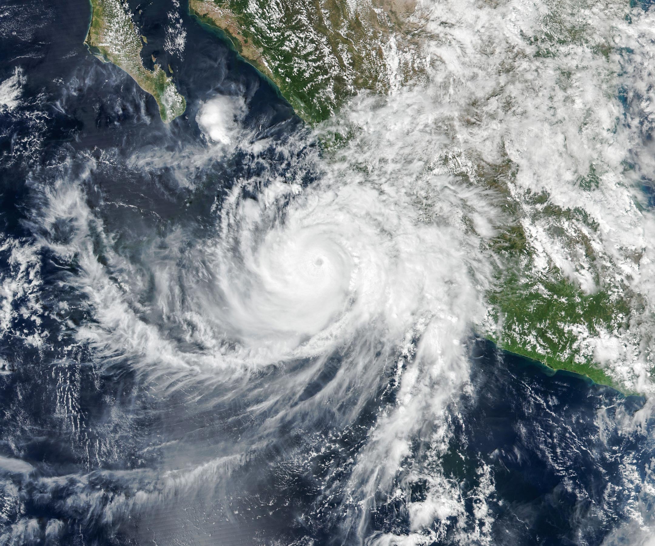
Simon was moving slowly north-northwest along the Pacific coast of Mexico. NASA's Suomi NPP satellite captured an image of the storm at about 2:30 pm local time. The eye of the hurricane is located between Manzanillo and Puerto Vallarta, about 50 kilometers away from the coast. Simon had previously reached Category 4 hurricane intensity, with maximum sustained wind speeds of about 250 kilometers per hour; the sustained wind speed recorded by the U.S. National Hurricane Center at the time of filming was about 210 kilometers per hour, and the core of the storm was passing the coast. Heavy rainfall has caused coastal flooding and increased the risk of landslides in mountainous areas.
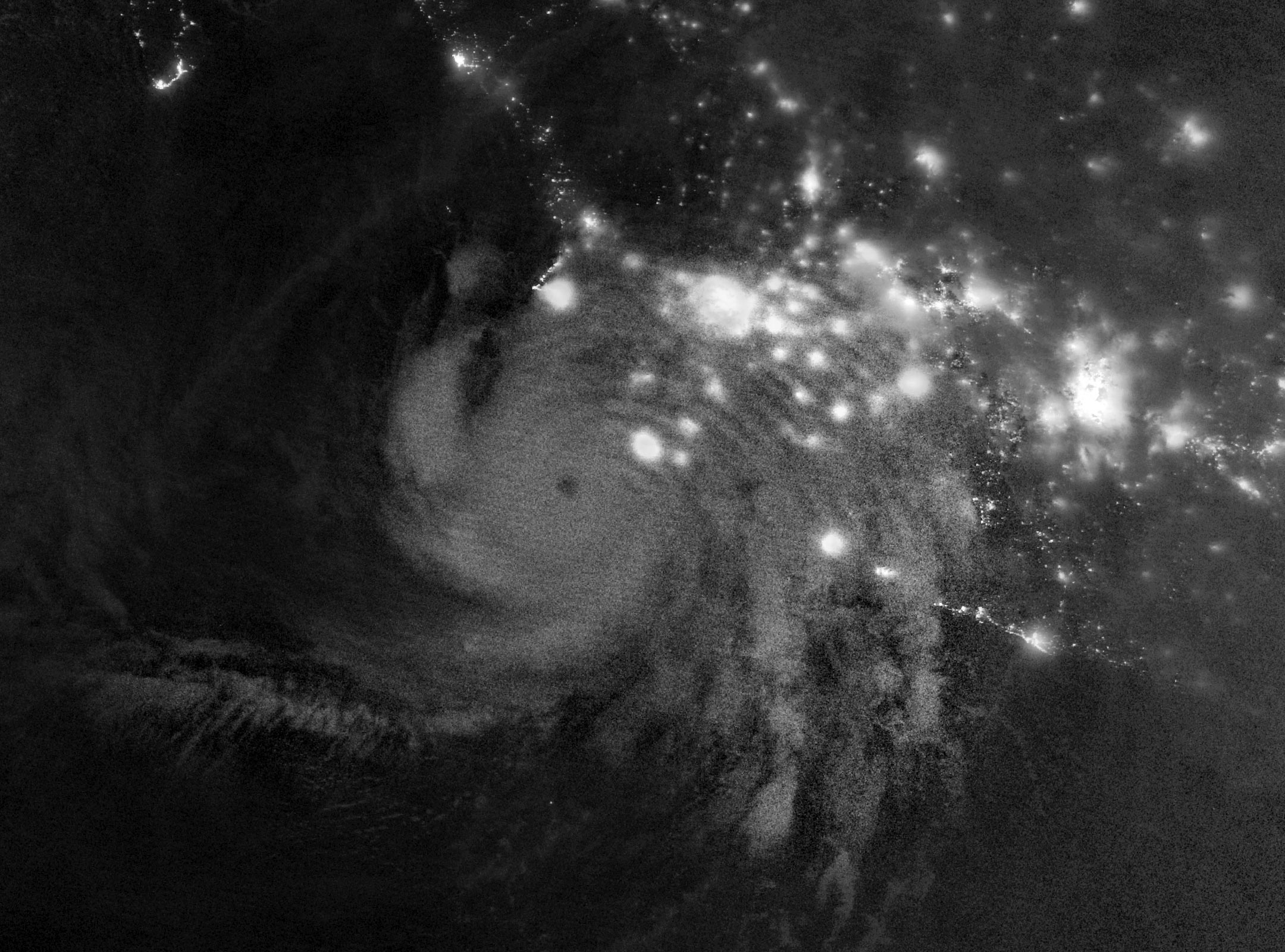
Another nighttime image, taken by the VIIRS instrument aboard the NOAA-21 satellite, shows ripples radiating outward from the storm. Severe thunderstorms near the hurricane's eyewall release latent heat stored in the condensation of water vapor, pushing warm, moist air up quickly to form towering cumulonimbus clouds. Atmospheric disturbances caused by strong convection can propagate upward, pass through the stratosphere and reach the mesosphere; when the fluctuations affect the weak natural glow emitted by high-altitude air, they will appear as circles of light and dark patterns in satellite images.
This phenomenon is not seen in every hurricane. High-altitude winds may weaken the fluctuations before they reach the mesosphere. Although the day and night band of VIIRS can detect weak airglow, it will also receive moonlight reflections. Stronger moonlight can easily drown the airglow signal. The moonlight was very weak that night, so the high-altitude ripples were particularly clear.
Simon's subsequent path was once difficult to predict. Records from the U.S. National Hurricane Center show that the storm eventually weakened and dissipated on October 16, and the agency subsequently issued its final advisory. This satellite image shows how the impact of a severe tropical cyclone extends beyond clouds and near-surface weather to the atmosphere dozens of kilometers above the ground.
Comments