
Abstract:
The United Nations General Assembly will vote this week on a resolution on how world maps should be presented. The resolution, proposed by Togo and supported by the African Union, aims to push the world to gradually reduce reliance on traditional Mercator world maps and instead adopt equal-area map projections that more accurately reflect the actual areas of continents and countries, including the "Equal Earth" map that has received widespread attention in recent years.
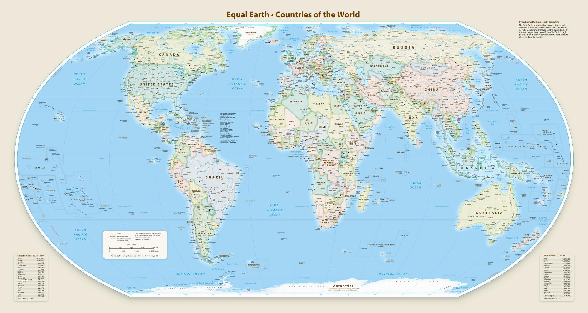
Sponsors of the proposal believe that the Mercator map, currently the most common map in the world, has systematic distortion in the area display. Because this projection method continues to enlarge the land area as latitude increases, countries and regions located at high latitudes appear particularly large on the map, while countries and regions near the equator are compressed. The African continent is one of the most typical examples.
For a long time, the intuitive impression formed by many people through world maps is that the area of Africa and Greenland is not much different. However, in fact, the area of the African continent is about 30.3 million square kilometers, while the area of Greenland is only about 2.16 million square kilometers. The former is about 14 times the latter. Advocates point out that Africa's actual area is even large enough to accommodate the combined land area of the United States, China, India, Japan, Mexico and most of Europe, but traditional maps make it difficult for the public to form such a perception.
Togolese Foreign Minister Robert Doucet stated during relevant United Nations meetings that this initiative is not a political movement, but an action based on scientific facts. He emphasized that Africa is not seeking special treatment, nor is it asking for sympathy from the outside world, but just hopes that the world map can faithfully reflect the true geographical size of Africa.
According to the public draft resolution, governments, schools, international organizations and technology companies will be encouraged to give priority to the use of Equal Earth and other equal-area map projections when it comes to continental area comparison and geographical awareness education. The draft does not call for the complete abolition of Mercator maps, but hopes to gradually establish new standards around the world that are more consistent with actual area proportions.
The Mercator projection was designed by the Flemish cartographer Gerardus Mercator in 1569. Its original purpose was to serve navigation. Because this projection can display the route of a ship sailing along a fixed orientation as a straight line on the map, it was of great practical value in the Age of Discovery and eventually became one of the internationally accepted world map standards. Even in the digital age, such maps are still widely used in school textbooks, government publications and Internet map services.
However, controversy over Mercator's map has raged for many years. Historians and geographers generally point out that the map was valuable in the field of navigation but was not suitable for accurately showing the relative size of various regions of the world. Some scholars further believe that the long-term use of this projection method has invisibly strengthened people's cognitive biases about the importance and influence of different regions. Some activists even refer to this phenomenon as “cartocolonialism”, arguing that it visually magnifies the presence of developed countries in the Global North while shrinking the geographical image of Africa and other regions of the Global South.
Behind this UN vote is also closely related to the #CorrectTheMap movement that has emerged in recent years. The movement calls for a re-examination of world map drawing standards, hoping to make map displays closer to real geographical conditions. In 2025, the African Union officially expressed support for this movement, and subsequently entrusted Togo to promote relevant issues at the international level to enter the United Nations discussion process.
Analysts believe that even if the resolution is finally passed, since the UN General Assembly resolution itself does not have enforceable effect, the global map system will not change immediately. However, this vote still has important symbolic significance. In the future, it may affect the compilation of school textbooks, the publication standards of international organizations, and the development direction of map products of technology companies, thereby gradually changing people's traditional understanding of the world's geographical pattern.
Comments