
Abstract:
The latest monitoring data from the European Space Agency's "Copernicus Sentinel-1" satellite shows that the Petermann Glacier in northwest Greenland collapsed violently on August 4. A giant ice shelf with an area of 76 square kilometers and a thickness of nearly 150 meters broke off and drifted into the Arctic Ocean as a free-floating flat-top iceberg (also known as "Iceland").
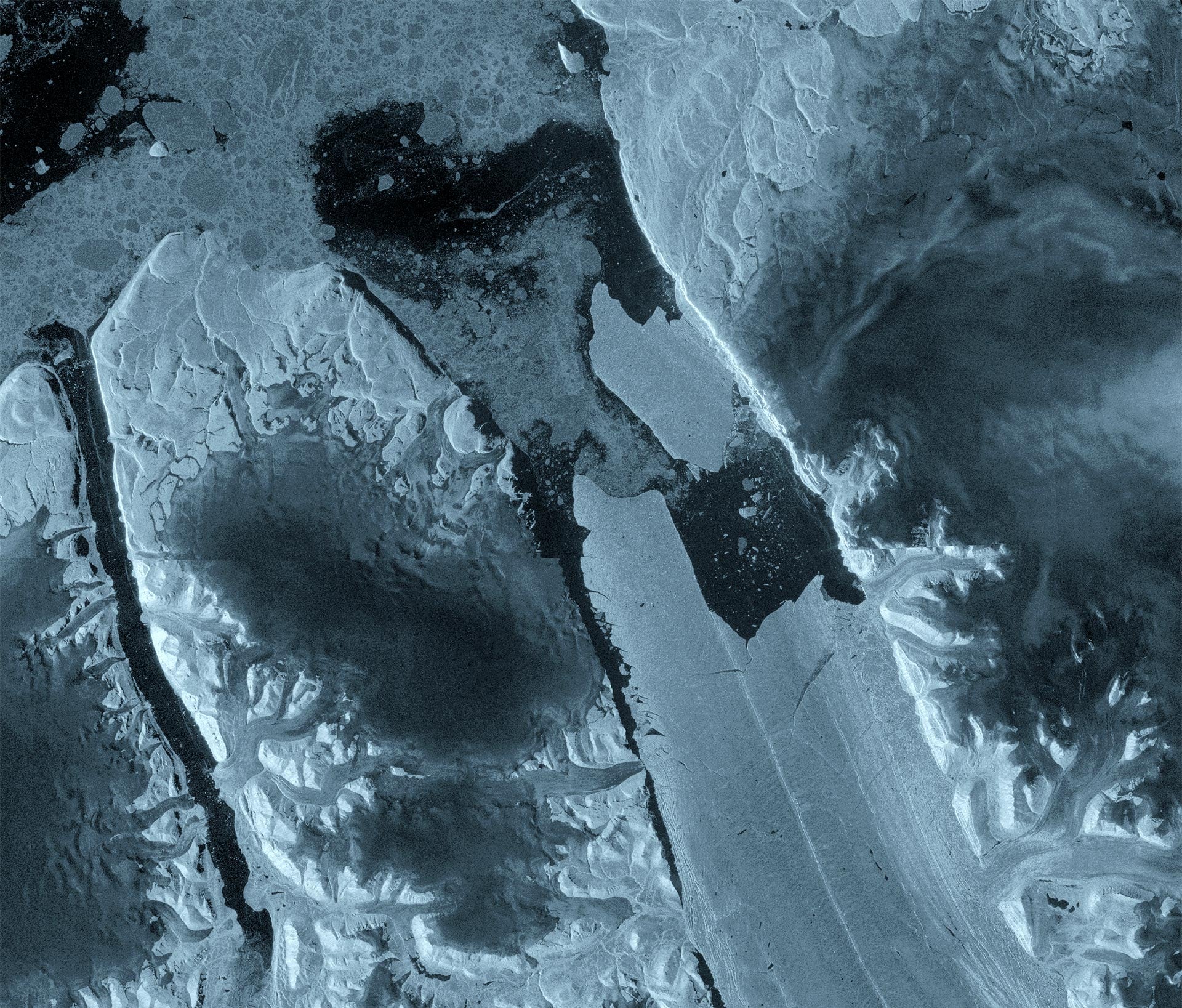
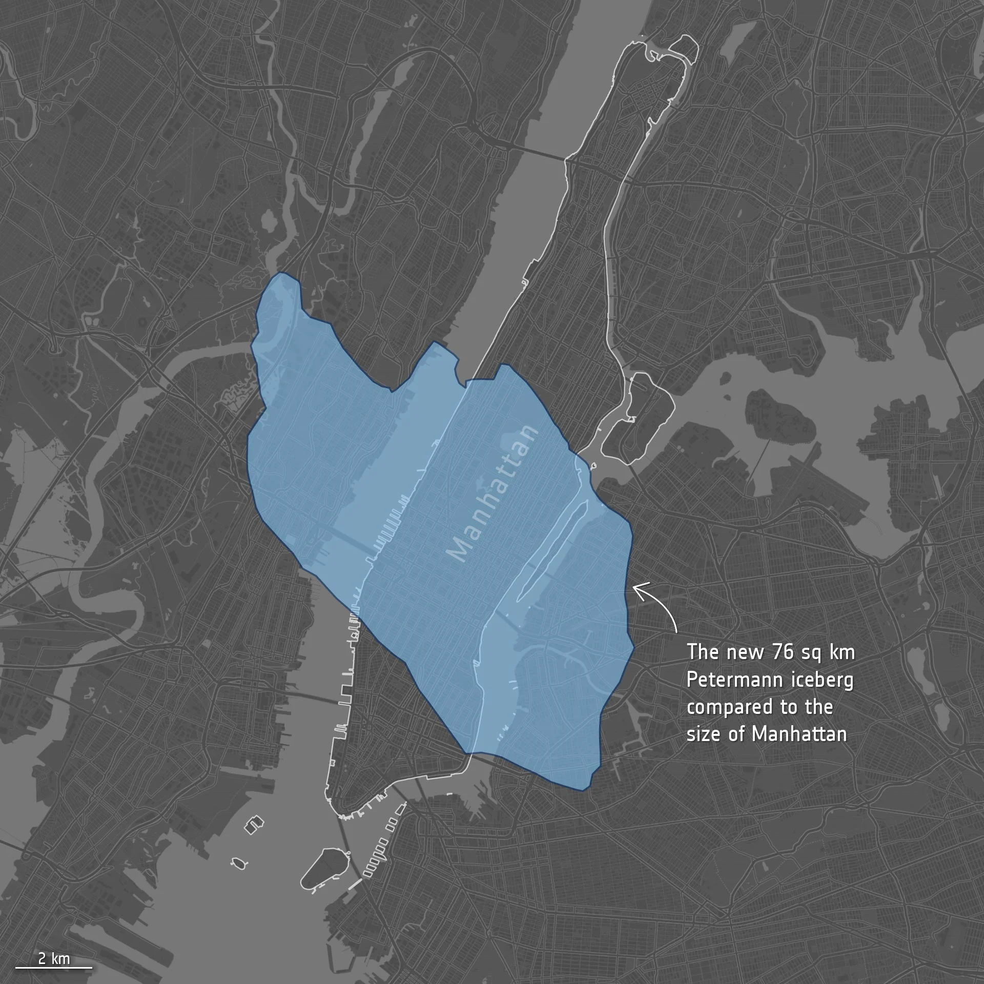
The area of this body of ice is equivalent to the size of Manhattan Island in New York, USA, and its thickness is equivalent to nearly 50 floors of a skyscraper. This is the largest ice calving event in the glacier since 2012 and the largest ice shelf break recorded in the entire Arctic region since 2020. It has attracted widespread attention from polar scientific research and monitoring agencies.
The Petermann Glacier is one of the most important sea-entering glaciers in northwest Greenland. It is also one of the few glaciers in Greenland that still retains a giant floating ice tongue. After experiencing a series of large-scale calvings in 2008, 2010 and 2012, its floating ice tongue has been relatively stable for more than ten years, with only small-scale ice loss. However, a multinational joint scientific research team composed of the University of Ottawa in Canada, the University of Stirling in the UK, Lancaster University, the University of Leeds and the Canadian Ice Service has been tracking stress changes and fine cracks inside the glacier since 2019. In April this year, satellite interferometric radar measurements showed that continued deformation and cracking were occurring in the deep layers of the ice tongue, indicating that structural collapse was inevitable.
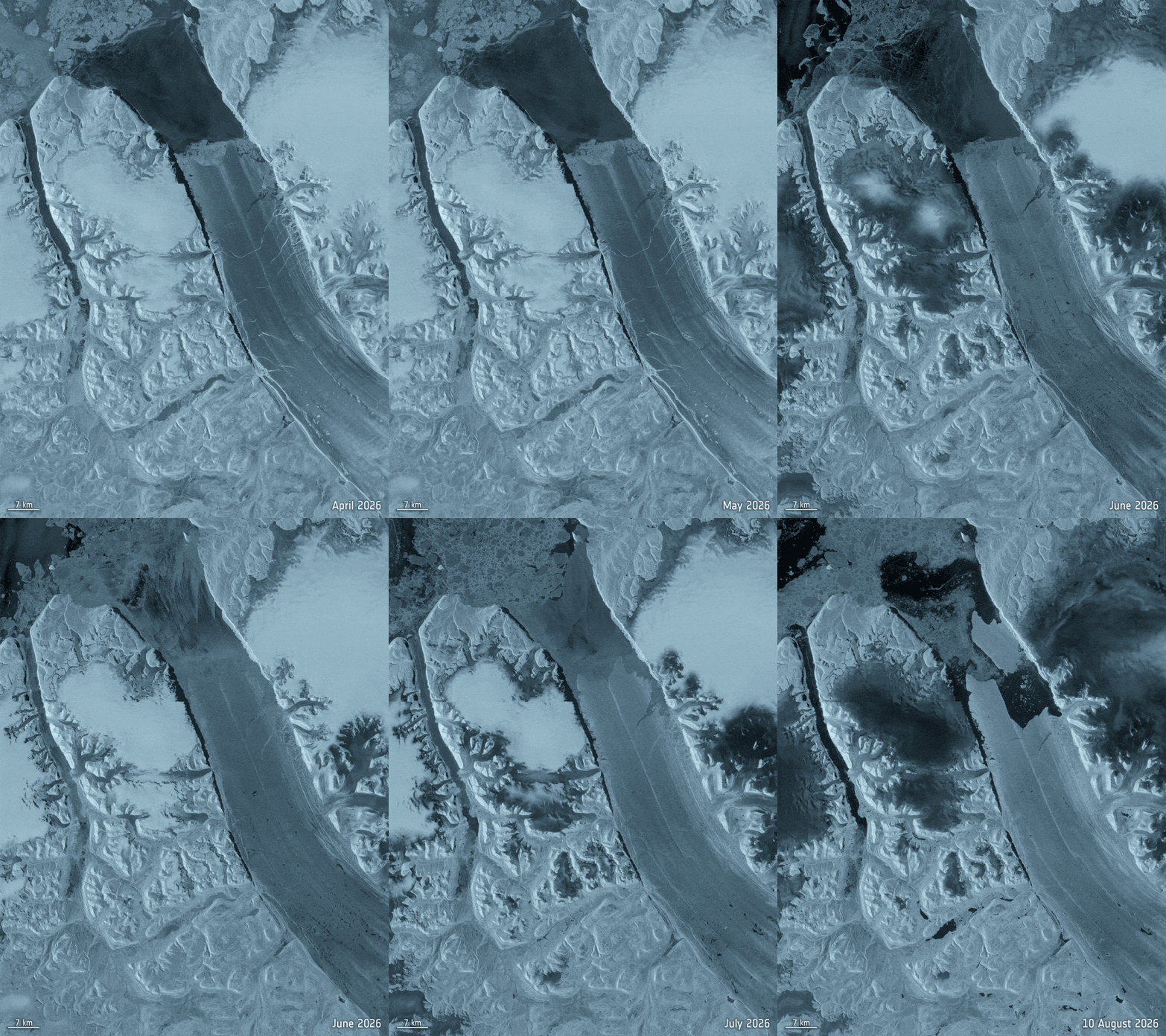
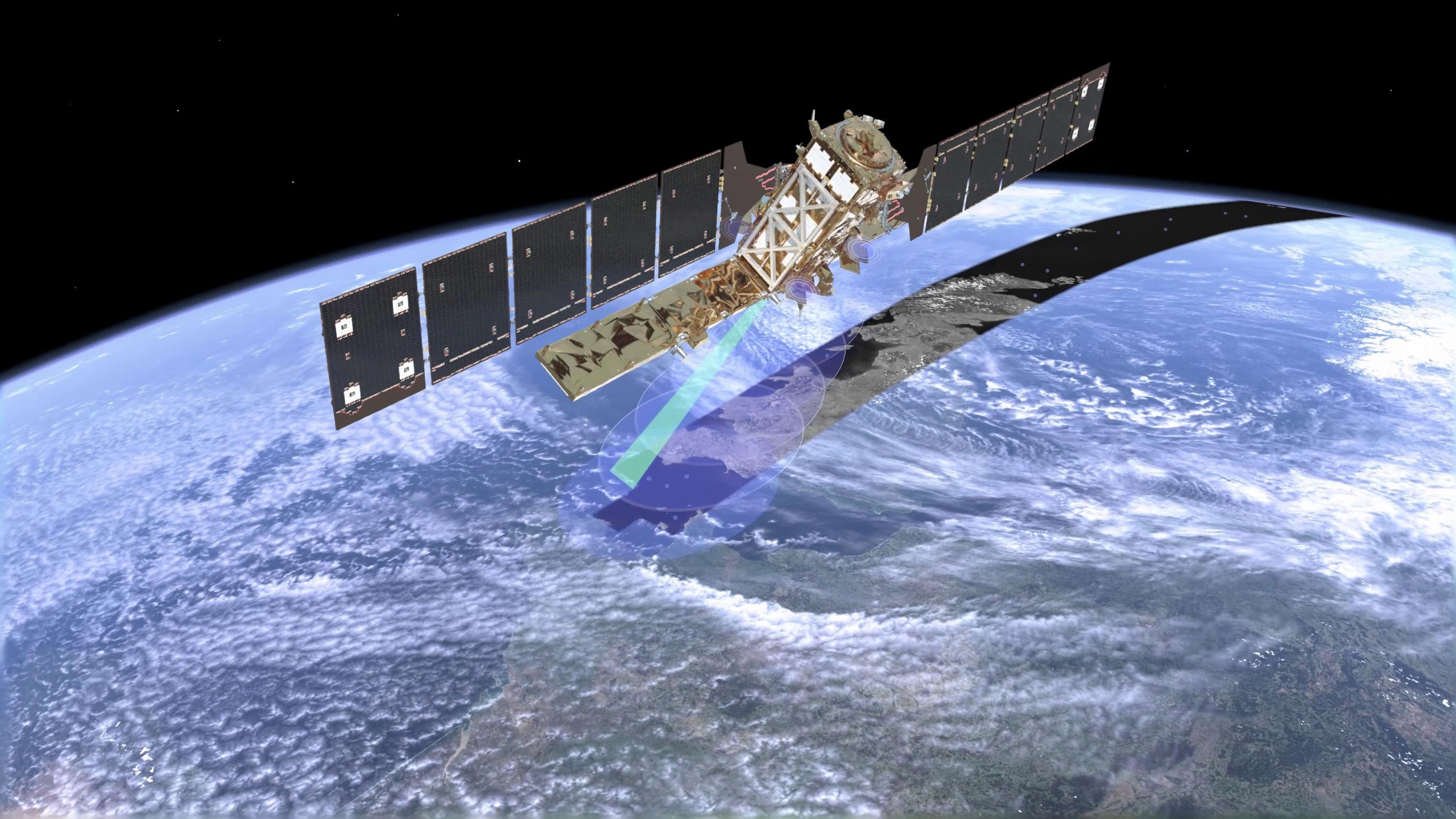
Thanks to the advancement of polar satellite observation technology, scientific researchers witnessed the entire process of this ice collapse almost in real time. At that time, the European Space Agency's Sentinel-1D satellite was undergoing handover testing with the Sentinel-1C satellite. The orbital coordination of the two satellites provided a rare single-day high-frequency radar revisit monitoring. Synthetic aperture radar has the advantage of penetrating the dense clouds and darkness of the polar night in the Arctic. The images returned on August 3 showed that the original cracks in the middle of the ice tongue sharply worsened and penetrated at an extremely fast speed; less than 24 hours later on August 4, the entire east side of the ice body completely tore off and fell off. Molly Hammond, a researcher at the University of Leeds who participated in the data processing, said that being able to witness the rapid expansion and eventual fracture of cracks under the influence of tides in near-real-time high-resolution satellite images is an extremely shocking and critical record in polar remote sensing observations. Adam Garber, a researcher at the University of Ottawa, pointed out that although the scientific community has been anticipating this rupture for many years, the rapidity of the actual rupture is still alarming and visually demonstrates how quickly the polar glacier system transforms after crossing a critical point.
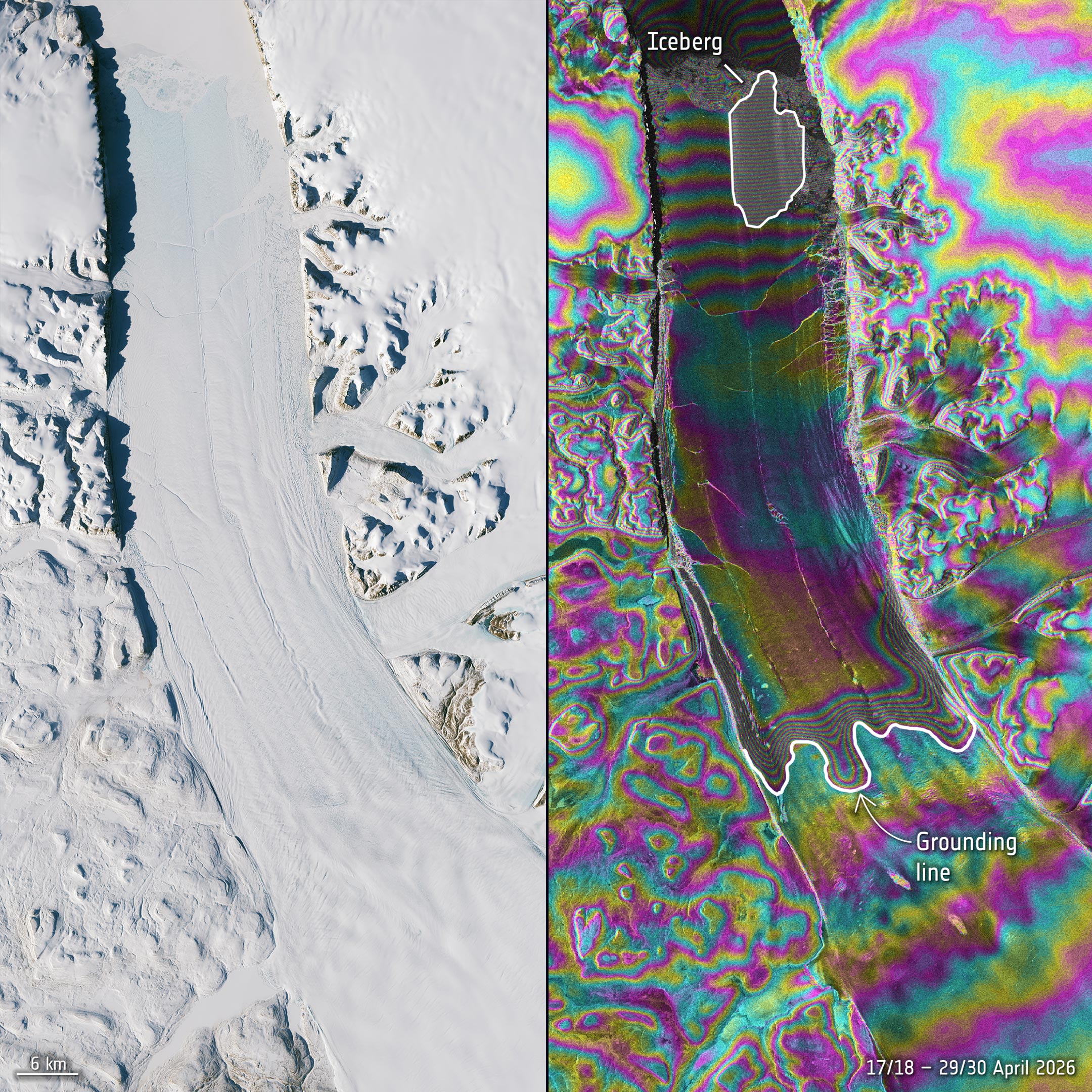
The scientific research team emphasized that the rupture on August 4 may not be the end of this cycle of instability of the Petermann Glacier. The latest high-precision radar images show that the remaining parts of the main body of the ice tongue have penetrated two other giant deep cracks. According to calculations, if the existing cracks continue to spread, two super icebergs with an area of approximately 97 square kilometers and 87 square kilometers may disintegrate in succession, both of which will be larger than the one that just fell off. Dr. Anna Crawford from the University of Stirling said that such large flat-top icebergs are rare in the Arctic. Tracking the process of structural weakening, fracture and subsequent interaction with ocean heat will provide extremely valuable first-hand physical data for improving global polar ice cap dynamic models and predicting sea level rise.
In addition to its long-term climate science value, this newly formed giant iceberg also poses imminent real-life security risks. Currently, Environment and Climate Change Canada has launched real-time tracking of its drift trajectory. Such a huge body of ice will drift in the open ocean for several years and gradually break into hundreds of small icebergs of different sizes and irregular shapes due to wind, waves and seawater erosion. As their size decreases, these remaining debris will become increasingly difficult to detect in radar reflections and visual searches, posing a continuing threat to navigation safety on commercial cargo ships, scientific research vessels, and coastal marine engineering infrastructure in the Arctic waterways.
Comments