
Abstract:
Was Mars once a water world? How long has water existed on Mars? China is about to draw a new generation of geological map of Mars, trying to restore the past and present life of the red planet.
This reporter learned this on September 28 at the high-quality development symposium of the Institute of Geology, Chinese Academy of Geological Sciences. Hou Zengqian, an academician of the Chinese Academy of Sciences and chief scientist of the Tianwen-3 mission, revealed at the meeting that the map is scheduled to be completed by the end of 2028. Based on the new discoveries of the Zhurong Mars rover, a Chinese plan for the geological age classification of Mars will be proposed, and my country's age division plan will be promoted to become a global consensus.
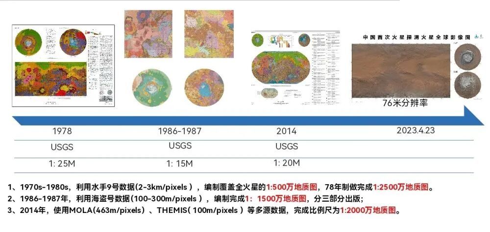
Early global geological map of Mars. (Photo courtesy of the Institute of Geology, Chinese Academy of Geological Sciences)
The discovery of Zhurong provides new clues to "whether there was water on Mars": Mars still had an intercontinental-level ancient ocean 3.5 billion years ago, and there may have been a short-term flood 1.6 billion years ago, filling the chain of evidence for ancient climate evolution. These findings will inform a new generation of geological maps of Mars. The new generation of maps will formulate a new plan for dividing the geological age of Mars based on this, breaking through the limitations of traditional reliance on international standards.
In terms of data, the new generation of maps will make maximum use of Tianwen-1 data, and coordinate the use of Mars exploration data from the United States and the European Space Agency to achieve collaboration between orbit and ground data. Multi-modal data such as imagery, spectrum, radar, gravity, and magnetic field will be cross-fused to establish a global multi-physics coupling database for Mars.
Technically, artificial intelligence will be deeply involved in Mars remote sensing interpretation - the professional knowledge of geologists will be embedded in large models through rules engines to improve interpretation interpretability; multi-scale attention technology will solve the problem of large spatial scale spans of Mars geological bodies, forming progressive feature extraction from local mineral identification to global tectonic unit division.
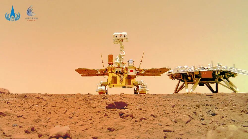
Zhuronghao. Published by Xinhua News Agency (Photo provided by China National Space Administration)
Yang Zhiming, director of the Institute of Geology of the Chinese Academy of Geological Sciences, said that geological mapping has always been one of the core tasks of the Institute of Geology since its establishment 70 years ago. From the region to the country, from the country to Asia, and from the earth to the moon and Mars, the service targets extend from resource exploration to deep space exploration, providing scientific foundation for China’s planetary exploration project to “where to explore, what to explore, and why to explore”.
The core achievements of the new generation of full Mars geological map include the completion of a 1:5 million full Mars geological map, a 1:50,000 landing area geological map and a professional series of atlases by the end of 2028, and the release of the world's first intelligent Mars geological map, which will provide research paradigms and implementation templates for subsequent mapping tasks of the moon, Venus, asteroids, etc.
Comments